U.S. Forest Service: Ryan Fire In Southern Wyoming Is Human-Caused
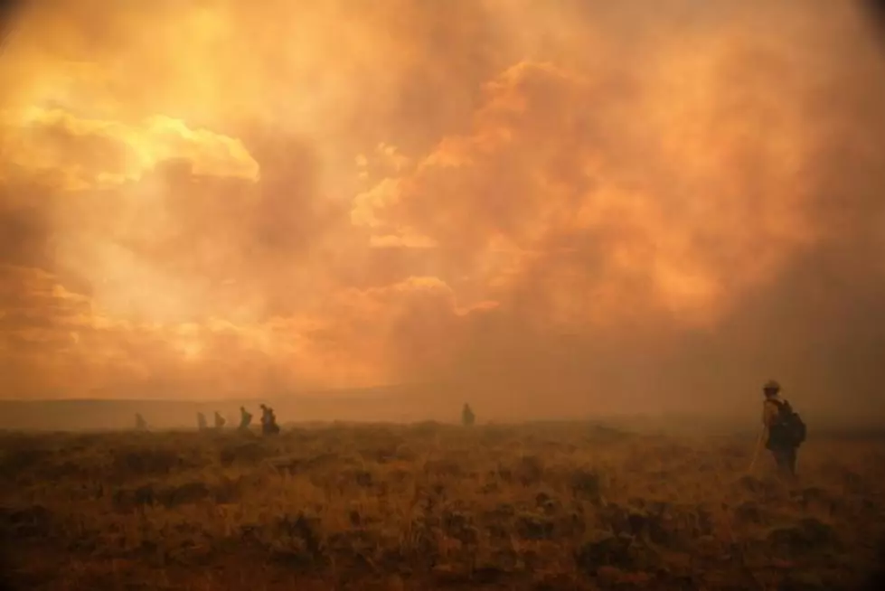
The U.S. Forest Service has determined someone who did not control a campfire caused the Ryan Fire, which has burned over 33 square miles in southern Wyoming and northern Colorado, according to a news release from the Forest Service on Friday.
Wildland fire investigators located the origin area of the fire three miles southeast of Hog Park Guard Station, two miles south of the state line, and two miles west of Buffalo Ridge Trailhead, in Jackson County, Colo.
The fire remains under investigation.
The Ryan Fire was first reported on Sept. 15, and restrictions were in place at that time prohibiting campfires outside of approved Forest Service fire rings. Those restrictions remain in effect throughout the Routt National Forest and the Sierra Madre Range, Medicine Bow National Forest.
The fire has grown to nearly 33 square miles and is 35 percent contained. The recent moderate weather has slowed the spread of the fire burning largely in beetle-killed lodgepole pine and spruce/fir, and 321 firefighting personnel have determined two structures and 10 outbuildings were destroyed last weekend.
Hotter and drier temperatures are expected to return through the end of the week creating the chance for increased fire behavior.
An area closure is in place for National Forest System lands surrounding the Ryan Fire to protect the public and fire personnel, and will remain in effect until rescinded. This closure is on portions of both the Medicine Bow and Routt national forests.
The closure area primarily affects hunters with licenses in game management unit 161 in Colorado, and elk area 13 and deer area 81 in Wyoming. Hunters are encouraged to obtain a copy of the area closure map before heading into the field. The complete closure order and map are available on the Ryan Fire InciWeb page.
Forest Service law enforcement received information from the public, but needs more.
If you have information, please call the Fire Information line at (307) 314-9408 about activity along the National Forest System Trail 1152 (Encampment trailhead to the north, Diamond Park trailhead to the south) and the Encampment River, and in the extreme northern tip of the Mount Zirkel Wilderness, Routt National Forest.
Officers are particularly interested in hearing from hunters who may have been in the Colorado Game Management Area 161.
When calling the Fire Information line, be ready to provide your name or contact information; and information about the date, time, location, and any identifying facts about the activity being reported. A Forest Service Law Enforcement Officer will follow up with members of the public who provide tips. Details and facts will be helpful in identifying responsible individuals.
More From Rock 96.7


![Wyoming-Boise State is Two Days Away [VIDEO]](http://townsquare.media/site/104/files/2018/09/IMG_2423.jpg?w=980&q=75)
